Colorado Landscapes
Click on any one of the photos below to see the photos in full-screen. Then scroll through the photos using the arrows on the left and right.
To remove the text, click on the “i”. To remove the filmstrip at the bottom, click on the little arrow just above.
Click on photo for large image.
Turn horizontal for landscape photos
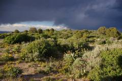
Upper Greasewood Creek
Upper Greasewood Creek is located in Rio Blanco County just east of Rangley, Colorado. The creek is surrounded by a couple of mesas with several interesting plant communities and beautiful views of the surrounding country. It has been designated as a protected natural area by the Colorado Department of Parks and Wildlife. Photo by Mo Ewing.
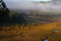
East Lost Park
East Lost Park lies south of Bailey in Park and Jefferson Counties. It is situated in the Lost Creek Wilderness Area, encompassing 16,798 acres and was designated a wilderness area in 1966. The stream, Lost Creek disappears underground and reappears on the surface at least nine times. Photo by Mo Ewing
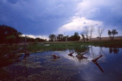
Arikaree River
The Arikaree River, unlike the South Platte and Arkansas Rivers, does not flow from the Rocky Mountains to the eastern border. Its headwaters start on the Great Plains in the far eastern portion of Elbert County and it flows out of Colorado in Yuma County. East of our border it flows into the North Fork of the Republican River. It is fed mostly by groundwater and summer storms. Photo by ewingphoto.com
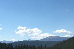
Geneva Basin
Geneva Basin is perhaps Colorado's most famous abandoned ski area. It was located between Grant and Georgetown on Guanella Pass Road. The peak at 11,750 feet altitude was opened in 1961 and was called Indianhead Ski Area. It had various owners but was closed in 1984 when an empty chair on the Duck Creek lift fell from the cable at which point, he Colorado Tramway Board shut the ski area down permanently. Now back-country skiers occasionally visit and ski the area in winter. Photo by Susan-Tamulonis.
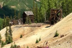
Red Mountain Pass
This is the ruins of one of the several mines on Red Mountain pass, elevation 11,018 feet. It is located in the Red Mountain Mining District on Route 550 between Ouray and Silverton, called the "Million Dollar Highway". The mines along this road were built during the historic but short silver boom between 1882 and 1893. The road is paved and passes through three abandoned towns, but drive carefully because the road is narrow, steep and winding in several places. Photo by Lea Baca.
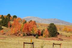
South Park
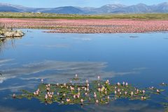
South Park is one of three mountain parks in Colorado. All of these contain mountain grasslands, but South Park is home to some famous extreme rich fens. South Park is accessed from Denver via Route 285 which enters from the north over Kenosha Pass where you will see the most spectacular views of the area with the Mosquito Mountains in the background. Photo by Linda Smith.
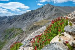
Father Dyer Peak
This photo was taken by Tom Lebsack from the trail to Upper Crystal Lake in Summit County. The mountain in the background is Father Dyer Peak which is 13,615 feet high and is part of the Tenmile mountain range. Father John Lewis Dyer was a Methodist minister who visited the mining camps to preach to the miners in the mid-nineteenth century. He made many ascents of mountains in the Tenmile Range. The Tenmile Range is not actually ten miles, but contains ten peaks approximately one mile apart from Peak One at one end to Peak Ten at the other end. There is one 14er, Quandary Peak, in this range.
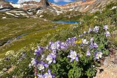
Island Lake via Ice Lakes Trail
Leslie Madson took this photo on the Island Lake via Ice Lakes Trail outside of Silverton, CO. The trail is 7.7 miles long, considered difficult but is popular for hiking, snowshoeing and rock climbing. It has some of the most breathtaking views in the state, including waterfalls, creeks and Fall colors. The color of Ice Lake is extraordinary.
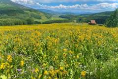
Swampy Pass Trail
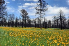
Swampy Pass Trail is a 10.9 mile out and back trail a bit southwest of Crested Butte off County Road 730. It is located in the West Elk Wilderness and is open to hikers or horseback riding. The flowers covering the meadow in the photo are Mule's Ears (Wyethia amplexicaulis). The photo by Steve Pearlman.
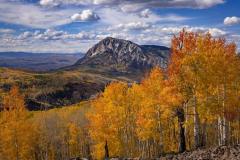
Marcellina Mountain, Ruby Range
This is a photo of Marcellina Mountain with aspens in full fall color. It is taken from the Ruby Range, which is just on the other side of Crested Butte from Keebler Pass. The Ruby Range has nine peaks, relatively close to each other, the highest being Mt. Own at 13, 058'. Marcellina Mountain is a 11,353 peak, and is is located in the Raggeds Wilderness of Gunnison National Forest. There are plenty of hiking trails both on Marcellina Mountain and the Ruby Range. The photo was taken by Bill Bowman.
