photo of kenosha pass and aspens in fall

Colorado Life Zones

Diversity of Life Zones
One of the reasons that Colorado plants and habitats have such a diverse flora is that our state has six altitude life zones. According to the Merriam Webster Dictionary, a life zone is defined as being “a region characterized by specific plants and animals.” In Colorado our life zones occur primarily, but not completely, because of our vast variation in altitude. Our lowest point is 3,315 feet on our eastern border where the Arikaree River crosses into Kansas. Our highest altitude is on Mount Elbert, at 14,433 feet, 12 miles southwest of Leadville in Lake County.

Our life zones do not only occur because of altitude, however, but also because of annual precipitation. The change in flora due to altitude is visually evident as you climb from the plains to the alpine.

Eastern Plains
From our lowest to highest points here are our six alpine life zones: The eastern prairie, which occurs from 3,315′ to about 6,000′ is dry, primarily grasslands. Annual precipitation varies from about 12” in the Arkansas Valley to 18” in the northeast and southeast corners of the state and gradually increase as one moves from east to west toward the mountains. The foothills occur from about 6,000′ to 8,000′ and with slightly higher precipitation are often dominated by shrub communities, consisting of such dry adapted species as Gambel oak and Mountain Mahogany.

Montane
The montane life zone occurs from about 8,000′ to 10,000′ and again, the moisture increases to the range of 25” – 30” per year. Here one finds forests dominated by species like Ponderosa Pine which are well adapted to dry, fire prone ecosystems. 

Alpine and Sub-Alpine
Moving higher into the subalpine at 10,000′ – 11,500′, moisture increases toward 40” per year and the forests change to Englemann spruce and subalpine fir, species more adapted to more moisture and frigid snow-filled winters. Then to the alpine above,11,500′ the weather is too harsh and the trees drop away and the plant communities change to alpine fell-fields and tundra.

Continental Divide
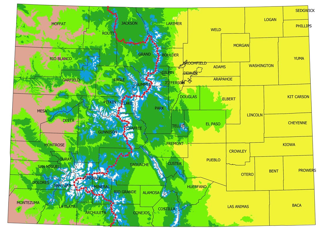
In the attached map, one can see that Colorado is split down the middle by the Continental Divide, where all of the rivers on the east flow toward the Mississippi River and those on the west flow toward California. As one continues west, the altitudes drop down to those similar to the eastern plains, ranging from 4,336′ where the Colorado River crosses the western boundary into Utah up to the 6,000′ foothills.

Semi-desert Shrublands
The flora in this altitude life zone, however, is very different from that of the eastern plains. It is called semi-desert shrublands because it is dominated by desert shrubs like sagebrush and saltbush which thrive in drier ecosystems. The annual precipitation here is only 8” to 14” per year, and is evenly spread throughout the year, with slightly higher amounts falling in the winter. On the eastern plains, 70 – 80% of the annual precipitation occurs during the growing season, which is ideal for grasses.

In the section below we investigate our six altitude life zones, describing some of the most important plant communities and the native plants most likely to occur in that zone.

For more information on each Life Zone, and to see photos, scroll down, or click on the boxes under the map.

Colorado Altitude Life Zone Map

a map of Colorado altitude life zones

Click on each zone for more information and photos

References

Climate of Colorado, Colorado State University

Natureserve Explorer

SEINet

Mycology Collections Portal

North American Bryophyte Herbaria

Consortium of North American Lichen Herbaria

The Flora of Colorado – Jennifer Ackerfield

Colorado Flora, Eastern Slope, vol. 4, William Weber & Ron Wittmann

Colorado Flora, Western Slope, vol. 4, William Weber & Ron Wittmann

Bryophytes of Colorado, William Weber & Ron Wittmann

Peterson Field Guide to Mushrooms, Kent H. McKnight/Vera B. McKnight

Common Rocky Mountain Lichens, Larry L. St. Clair

Diversity of Life Zones
One of the reasons that Colorado plants and habitats have such a diverse flora is that our state has six altitude life zones. According to the Merriam Webster Dictionary, a life zone is defined as being “a region characterized by specific plants and animals.” In Colorado our life zones occur primarily, but not completely, because of our vast variation in altitude. Our lowest point is 3,315 feet on our eastern border where the Arikaree River crosses into Kansas. Our highest altitude is on Mount Elbert, at 14,433 feet, 12 miles southwest of Leadville in Lake County.

Our life zones do not only occur because of altitude, however, but also because of annual precipitation. The change in flora due to altitude is visually evident as you climb from the plains to the alpine.

Eastern Plains
From our lowest to highest points here are our six alpine life zones: The eastern prairie, which occurs from 3,315′ to about 6,000′ is dry, primarily grasslands. Annual precipitation varies from about 12” in the Arkansas Valley to 18” in the northeast and southeast corners of the state and gradually increase as one moves from east to west toward the mountains. The foothills occur from about 6,000′ to 8,000′ and with slightly higher precipitation are often dominated by shrub communities, consisting of such dry adapted species as Gambel oak and Mountain Mahogany.

Montane
The montane life zone occurs from about 8,000′ to 10,000′ and again, the moisture increases to the range of 25” – 30” per year. Here one finds forests dominated by species like Ponderosa Pine which are well adapted to dry, fire prone ecosystems. 

Alpine and Sub-Alpine
Moving higher into the subalpine at 10,000′ – 11,500′, moisture increases toward 40” per year and the forests change to Englemann spruce and subalpine fir, species more adapted to more moisture and frigid snow-filled winters. Then to the alpine above,11,500′ the weather is too harsh and the trees drop away and the plant communities change to alpine fell-fields and tundra.

Continental Divide
In the attached map, one can see that Colorado is split down the middle by the Continental Divide, where all of the rivers on the east flow toward the Mississippi River and those on the west flow toward California. As one continues west, the altitudes drop down to those similar to the eastern plains, ranging from 4,336′ where the Colorado River crosses the western boundary into Utah up to the 6,000′ foothills.

Semi-desert Shrublands
The flora in this altitude life zone, however, is very different from that of the eastern plains. It is called semi-desert shrublands because it is dominated by desert shrubs like sagebrush and saltbush which thrive in drier ecosystems. The annual precipitation here is only 8” to 14” per year, and is evenly spread throughout the year, with slightly higher amounts falling in the winter. On the eastern plains, 70 – 80% of the annual precipitation occurs during the growing season, which is ideal for grasses.

Colorado Altitude Life Zone Map

a map of Colorado altitude life zones
Click on each zone below for more information and photos

  – – – – – – Continental Divide

References

Climate of Colorado, Colorado State University

Natureserve Explorer

SEINet

Mycology Collections Portal

North American Bryophyte Herbaria

Consortium of North American Lichen Herbaria

The Flora of Colorado – Jennifer Ackerfield

Colorado Flora, Eastern Slope, vol. 4, William Weber & Ron Wittmann

Colorado Flora, Western Slope, vol. 4, William Weber & Ron Wittmann

Bryophytes of Colorado, William Weber & Ron Wittmann

Peterson Field Guide to Mushrooms, Kent H. McKnight/Vera B. McKnight

Common Rocky Mountain Lichens, Larry L. St. Clair

Diversity of Life Zones
One of the reasons that Colorado plants and habitats have such a diverse flora is that our state has six altitude life zones. According to the Merriam Webster Dictionary, a life zone is defined as being “a region characterized by specific plants and animals.” In Colorado our life zones occur primarily, but not completely, because of our vast variation in altitude. Our lowest point is 3,315 feet on our eastern border where the Arikaree River crosses into Kansas. Our highest altitude is on Mount Elbert, at 14,433 feet, 12 miles southwest of Leadville in Lake County.

Our life zones do not only occur because of altitude, however, but also because of annual precipitation. The change in flora due to altitude is visually evident as you climb from the plains to the alpine.

Eastern Plains
From our lowest to highest points here are our six alpine life zones: The eastern prairie, which occurs from 3,315′ to about 6,000′ is dry, primarily grasslands. Annual precipitation varies from about 12” in the Arkansas Valley to 18” in the northeast and southeast corners of the state and gradually increase as one moves from east to west toward the mountains. The foothills occur from about 6,000′ to 8,000′ and with slightly higher precipitation are often dominated by shrub communities, consisting of such dry adapted species as Gambel oak and Mountain Mahogany.

Montane
The montane life zone occurs from about 8,000′ to 10,000′ and again, the moisture increases to the range of 25” – 30” per year. Here one finds forests dominated by species like Ponderosa Pine which are well adapted to dry, fire prone ecosystems. 

Alpine and Sub-Alpine
Moving higher into the subalpine at 10,000′ – 11,500′, moisture increases toward 40” per year and the forests change to Englemann spruce and subalpine fir, species more adapted to more moisture and frigid snow-filled winters. Then to the alpine above,11,500′ the weather is too harsh and the trees drop away and the plant communities change to alpine fell-fields and tundra.

Continental Divide
In the attached map, one can see that Colorado is split down the middle by the Continental Divide, where all of the rivers on the east flow toward the Mississippi River and those on the west flow toward California. As one continues west, the altitudes drop down to those similar to the eastern plains, ranging from 4,336′ where the Colorado River crosses the western boundary into Utah up to the 6,000′ foothills.

Semi-desert Shrublands
The flora in this altitude life zone, however, is very different from that of the eastern plains. It is called semi-desert shrublands because it is dominated by desert shrubs like sagebrush and saltbush which thrive in drier ecosystems. The annual precipitation here is only 8” to 14” per year, and is evenly spread throughout the year, with slightly higher amounts falling in the winter. On the eastern plains, 70 – 80% of the annual precipitation occurs during the growing season, which is ideal for grasses.

In the section below we investigate our six altitude life zones, describing some of the most important plant communities and the native plants most likely to occur in that zone.

Colorado Altitude Life Zone Map

a map of Colorado altitude life zones
Click on each zone below for more information and photos

  – – – – – – Continental Divide

References

Climate of Colorado, Colorado State University

Natureserve Explorer

SEINet

Mycology Collections Portal

North American Bryophyte Herbaria

Consortium of North American Lichen Herbaria

The Flora of Colorado – Jennifer Ackerfield

Colorado Flora, Eastern Slope, vol. 4, William Weber & Ron Wittmann

Colorado Flora, Western Slope, vol. 4, William Weber & Ron Wittmann

Bryophytes of Colorado, William Weber & Ron Wittmann

Peterson Field Guide to Mushrooms, Kent H. McKnight/Vera B. McKnight

Common Rocky Mountain Lichens, Larry L. St. Clair

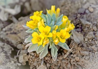
Alpine Plants

Altitude: 11,500′ – 14,433′

Foothills Plants

Altitude: 6,000′ – 8,000′

Subalpine Plants

Altitude: 10,000′ 11,500′

Plains Plants

Altitude: 3,315′ – 6,000′
(East Slope)

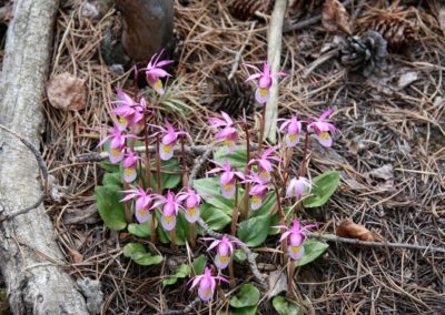
Montane Plants

Altitude: 8,000′ – 10,000′

Semi-desert Shrubland Plants

Altitude: 4,336′ – 6,000′
(West Slope)

Alpine Plants

Altitude: 11,500′ – 14,433′

Subalpine Plants

Altitude: 10,000′ 11,500′

Montane Plants

Altitude: 8,000′ – 10,000′

Foothills Plants

Altitude: 6,000′ – 8,000′

Plains Plants

Altitude: 3,315′ – 6,000′
(East Slope)

Semi-desert Shrubland Plants

Altitude: 4,336′ – 6,000′
(West Slope)

Non-Flowering Organisms

Lichens

Bryophytes

Mosses, Liverworts & Hornworts

Ferns

Fungi

Mushrooms