Colorado Landscapes
Click on any one of the photos below to see the photos in full-screen. Then scroll through the photos using the arrows on the left and right.
To remove the text, click on the “i”. To remove the filmstrip at the bottom, click on the little arrow just above.
Click on photo for large image.
Turn horizontal for landscape photos
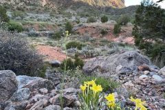
Monument Canyon
Monument Canyon is located in Colorado National Monument just west of Grand Junction. It is accessed by a 5-mile loop trail which descends 600 feet from the plateau into the canyon. On this trail you will find many of the wonderful rock formations in the national monument: Independence Monument, Kissing Couple, and the Coke Ovens. Photo by Mollie Freilicher.
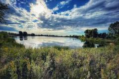
Pella Crossing Open Space
The pond in this photo at Pella Crossing Open Space in Hygiene, Colorado is just west of Longmont, It was a former gravel mine from 1975 to 1990. and was donated to Boulder County which opened it as open space in 1995. In the 1860s this area was known as Laramie Crossing where the Overland Stagecoach Trail from Denver to Laramie crossed the St. Vrain River. The open space offers fishing and walking trails. Photo by Tracy Csavina.
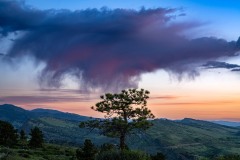
Rabbit Mountain
This is a photo of the Ron Steward Preserve at Rabbit Mountain (formerly Rabbit Mountain Open Space) in Boulder. This 5,000 acre preserve has three hiking trails from 1.2 to 4 miles long, great birding, horseback riding, biking and also has wildlife, including prairie dogs, lizards, snakes, mule deer, elk and mountain lions. Photo by Bill Bowman.
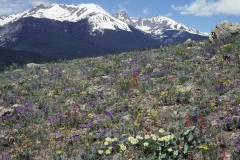
The Gore Range
The Gore Range runs approximately 60 miles from the south end of the Park Range from Rabbit Ears Pass (U.S. Highway 40) to the Eagle River and Gore Creek near Vail. It forms part of the western boundary of Middle Park which contains the headwaters of the Colorado river.
The range was named after Sir St George Gore, 8th Baronet, an Irish hunter who visited the area in the 1850s on a notorious three year hunting expedition through the Dakotas, Montana, Wyoming and Colorado where he claimed to have killed more than 2,000 buffalo, 1,600 elk and deer and 100 bears for sport. Photo by Loraine Yeatts
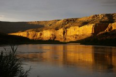
Horsethief Canyon, Colorado River
This is Horsethief Canyon, part of the Ruby and Horsethief section of the Colorado River from Loma, Colorado to Westwood, Utah. It flows in mostly flat water, for 25 miles with only one class II rapid. There are several places to hike along the river. The rock you see is 1.7 billion year old Vishnu schist, which is also found in the Grand Canyon. Photo by Mo Ewing.
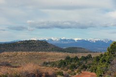
The Uncompahgre Plateau
The 1.5 million acre Uncompahgre Plateau is located in western Colorado, arising from the Colorado River at 4,600 feet to a maximum height of 10,300 feet at Horsefly Peak. It's boundaries are the Dolores and San Miguel Rivers on the west and the Gunnison and Uncompagre rivers on the east. The mountains in this photo are the San Miguels. Photo by Mo Ewing
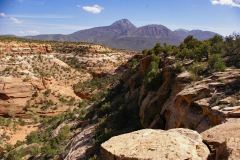
Sand Canyon
Sand Canyon is located on the southern side of Canyon of the Ancients, near Cortez, Colorado. Canyon of the Ancients is known primarily by the Sand Canyon Pueblo, an ancient ruin containing 400 rooms, but the area is also interesting for its beautiful canyons and wonderful diversity of native plants in the semi-desert shrubland life zone. Photo by Mo Ewing
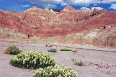
Lookout Mountain, Moffat County
Lookout Mountain is located in the Vermillion Basin in Moffat County. The area in this photo is on the base of the mountain on the western side. Dry and arid, it is home to plants that can survive in areas with little moisture. However, at the top of the mountain at about 8,100 feet you will find a suite of beautiful cushion plants. Photo by Mo Ewing
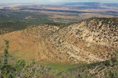
Yanks Gulch
Yanks Gulch, located in Rio Blanco County, is owned and managed by the Bureau of Land Management and has been designated a natural area by Colorado Parks and Wildlife. It contains excellent examples of mesic sagebrush shrublans, and western slope grasslands. Several species of rare plants are located there. Photo by Mo Ewing.
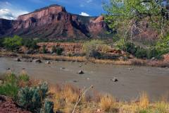
Uncompahgre River
The Uncompahgre River in southwestern Colorado. Its headwaters start in the San Juan mountains and it flows 75 miles to Confluence Park in Delta County where it meets the Gunnison River. There are two damns in the river, one small one is in the Uncompahgre Gorge, where this photo was taken. The second one is the Ridgeway Dam, below Ridgeway, Colorado, which forms the Ridgeway Reservoir.
Photo by Mo Ewing.
